After several inches around Western Washington of Christmas snow, KIRO 7 Chief Meteorologist Morgan Palmer said the last of the accumulating snow was moving through King County around 10:30 a.m.
Accumulations were spotty, but roads could still be difficult to travel. National Weather Service officials in Seattle said black ice could be an issue for roadways on Tuesday.
Some flights at Sea-Tac Airport were affected. Around 1 p.m., there were over 200 delayed flights and 20 flight cancellations. Check your flight status here.
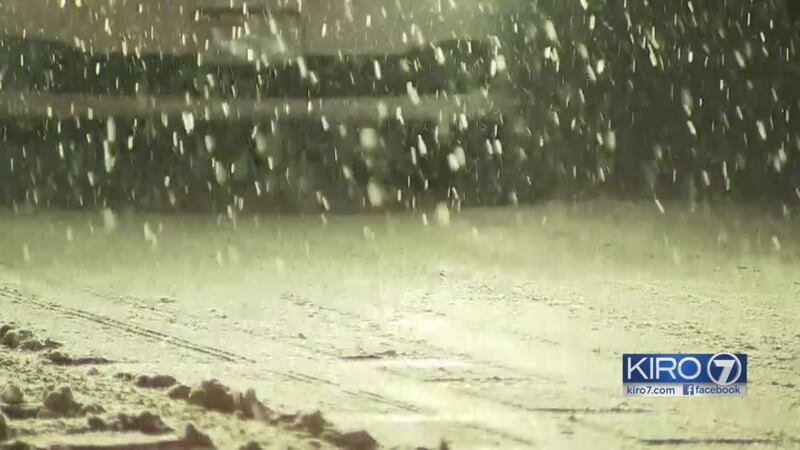
Snow was still coming down Monday morning around 11 a.m. in parts of Seattle.
Christmas Eve saw snowfall as well. Measurable snow on Christmas Eve in Seattle is a rare event, according to NWS Seattle officials. Since the 1890s, accumulation for that date is as follows:
- 1. 2.6" 2008
- 2. 2.5" 1926
- 3. 1.5" 1911
- 4. 0.8" 1965
- 5. 0.4" 1902
- 6. 0.3" 1971
Winter Weather Advisories were in effect through the early afternoon. Roads were slick and troublesome Christmas morning, especially on less traveled roads.
By late morning, there were fewer areas of precipitation.
In the mountains, snow showers will occasionally cause travel problems through the passes.
We'll be dry for most of Tuesday but a weak system moving in from the south will bring a rain/snow mix Tuesday night and early Wednesday before transitioning to all rain.
We'll be rainy Thursday and Friday but it will be warm enough for any snow to stay in the mountains.
Watch his up-to-the-minute KIRO 7 PinPoint Forecast live at 5 p.m. on KIRO 7. You also can watch on the KIRO 7 livestream.
Trending headlines
- What the black box revealed in the Amtrak train derailment
- Man accused of plotting Christmas Day terror attack in San Francisco
- 6-year-old killed by deputy's stray bullet in Texas
- Kasich signs bills banning abortions of Down syndrome fetuses
- Couple dead after murder-suicide at Seattle medical facility
- Family says raccoon attack left 4-month-old with 65 stitches
Cox Media Group


