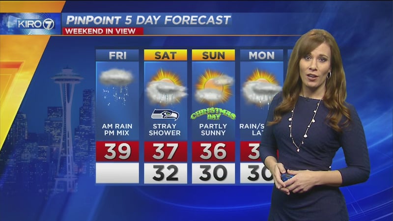
Snow and rain will be tapering through the evening across Western Washington but some flurries are possible into Saturday morning.
Locations above 200 feet in elevation still have the best chance for accumulations, which have occurred in many areas north of Seattle today.
A Winter Weather Advisory is in effect into tonight for Western Washington.
Drier air is gonna win out in #Seattle before the #wasnow level can really drop and stay at sea level. #wawx pic.twitter.com/DIJaGytO2T
— Morgan Palmer (@MorganKIRO7) December 23, 2016
Latest RPM model shows how quickly #wasnow ends (though light rain/snow showers or flurries into Saturday AM. (Loop is now-12a) #wawx pic.twitter.com/QD4jjnQwGD
— Morgan Palmer (@MorganKIRO7) December 23, 2016
A look at today's #wasnow in slow motion. >> https://t.co/Q8uqMgBWaJ pic.twitter.com/VlZQ1LULBR
— KIRO 7 (@KIRO7Seattle) December 23, 2016
What about a White Christmas?
In the lowlands, snow that does fall -- and sticks -- will mainly fade tonight and Saturday as ground temperatures remain warm.
>> Related: How to prepare for Northwest travel, weather before Christmas
Above 500 feet where snow amounts could well be heavier, we could see some pockets of snow (especially in shaded areas) sticking around into Christmas.
>> Download the KIRO 7 Weather app and get weather alerts
Unfortunately for snow lovers, the atmosphere quickly dries tonight into Saturday so aside from some flurries, we're not likely to get further precipitation.
Christmas Day looks dry with a mix of clouds and sun and highs in the 30s. It will be an EXCELLENT weekend for holiday skiing in the mountains!
Travel east of the Cascades, however, could be made difficult at times with slick spots on roadways.
Trending stories on kiro7.com
- Lowland snow in spots through Friday evening
- Amazon, Goodwill team up to use empty shipping boxes
- Man killed roommate in fight over chores
- Disabled Seahawks fan files ADA lawsuit against Ticketmaster
- Bellingham ranks as #4 most hungover city in US, report finds
Cox Media Group


