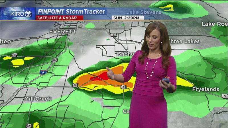
SEATTLE — Stormy weather was present throughout western Washington on Sunday. The weather in Seattle was changing and diverse.
Viewer Dusty Knight sent in a photo of a funnel cloud from south Everett -- looking toward Snohomish.
According to the National Weather Service in Seattle, the funnel cloud near Snohomish was visible in a video. They say it seemed to dissipate after a minute or so without reaching the ground.
NWS officials thanked all who reported the funnel cloud to them.
"Thank you to everyone who called in to report the funnel cloud in the Mill Creek/Snohomish area to us. Your help is greatly appreciated!" wrote officials over Twitter.
Looks like a cold air funnel...usually weak, high-based circulation that doesn't last very long. #wawx https://t.co/9vz7UEbYAd
— Kelly Franson (@KellyFranson) March 27, 2016
<strong>From KIRO 7's meteorologist, Kelly Franson >></strong>
"Conditions were right for a cold air funnel cloud. A cold air funnel is usually a high-based, weak circulation that can form as a cold air mass moves in behind a front. They usually don't last long and circulation is much weaker than a tornado that forms from a supercell thunderstorm."
KIRO 7 is tracking the weather and will update this story with the latest information.
#WAWX: Pics of funnel cloud near Snohomish, WA from Dusty Knight & Jason Mayfield. Info >> https://t.co/MOmR5yzZC7 pic.twitter.com/21YfWcYw1w
— KIRO 7 (@KIRO7Seattle) March 27, 2016
Cox Media Group


