KIRO 7 Meteorologists Morgan Palmer, Nick Allard, and Kelly Franson said on Saturday morning that it looked like the classic setup for a very strong windstorm in western Washington.
But the storm was not nearly as strong as first forecasted. Here's why.
"The obvious: Low pressure didn't deepen when data indicated it," said Palmer. "And we were only able to see this in near real-time earlier today. But the threat was there."
>>RELATED: Why winds weren't strong as expected
But some areas were hit with damaging winds, especially in the North Sound and at the coast.
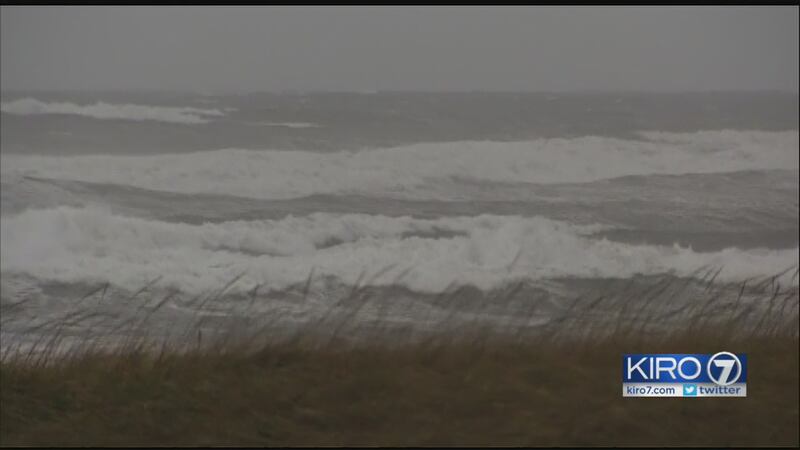
>> PHOTOS: Damage from Pacific Northwest storm
Tree down at apartment in Sedro Wooley. Crews chainsawing it in clean-up efforts. #wawx pic.twitter.com/VZuFmmblUr
— KIRO 7 (@KIRO7Seattle) October 16, 2016
TIMELINE OF STORM:
[9:06 p.m.] US 101 near Soleduck Hot Springs Rd is back open. Trees cleared from road.
[9:05 p.m.] Bothell police: Main St and surrounding area power has been restored. Lots of H2O on roads, drive safely.
[8:59 p.m.] Whatcom County Ferry: Due to high winds ferry service is suspended until further notice.
[8:46 p.m.] About 800 customers in Montlake have had power restored. About 700 in Montlake remain without power.
[8:34 p.m.] Power outages: More than 25,000 customers without power.
[8:30:p.m.] High wind warning downgraded to advisory for Puget Sound; High wind warning remains for north.
[8:18 p.m.] Snohomish County PUD's outage map shows more than 6,400 customers without power in Hilton Lake area of Everett.
[8:16 p.m.] Trees down on both dirs. US 101 near Soleduck Hot Springs Rd at mp 220. The roadway is fully blocked.
[8:12 p.m.] Morgan Palmer: Still breezy out there and we could still get 50+ gusts around Bellingham and the San Juans.
[8:11 p.m.] Bellingham weather: A Personal Weather Station in Edgemoor recorded a gust of 52.6mph at 745pm & sustained winds 37.4mph at 740pm
[8 p.m.] Grays Harbor PUD said there are no remaining major outages from the storm.
[7:45 p.m.] National Weather Service: North interior (including San Juans, Whatcom/Skagit) you can still see gusts up to 60 MPH. The threat for damaging wind has not passed.
[7:40 p.m.] National Weather Service: The threat for strongest winds --over northern areas, not metro area. The storm track does not favor Seattle area for damaging winds.
[7:31p.m.] More than 35,000 customers without power.
[7:13 p.m.] Threat for stronger wind than what has already occurred is now unlikely in Tacoma and Olympia.
[7:07 p.m.] Port Townsend/Coupeville ferry service canceled.
Taking an look at why winds weren't as strong today. The obvious: low pressure didn't deepen when data indicated it would! 🤔 #wawx #wawind pic.twitter.com/gekCZRGiW3
— Morgan Palmer (@MorganKIRO7) October 16, 2016
[6:52 p.m.] Power out for over 15,000 around Puget Sound. About 3,000 in Montlake/Portage Bay/ Eastlake.
[6:47 p.m.] Power has been restored to ~3,000 customers in SE Seattle.
[6:45 p.m.] Winds picking up on West Queen Anne.
[6:40 p.m.] Tree on a line in Midland (South Sound). About 1,700 customers without power - down from 11,000.
[6:30 p.m.] Line of rain, hail moving east across Puget Sound.
[6:10 p.m.] Power outages affecting more than 20,000 customers.
[6:05 p.m.] Power out in Fall City.
[6:03 p.m.] Reporter Henry Rosoff says wind gusts at Alki Beach range from 40-50 mph.
[6 p.m.] Number of power outages across region tops 16,000.
[5:55 p.m.] Power is out to 260 customers in Carnation.
[5:54 p.m.] City of Bainbridge Island: Power is out in Winslow. Winds are expected to increase.
Uprooted tree in Mukilteo, Wash.
— KIRO 7 (@KIRO7Seattle) October 16, 2016
Photo from Kelsie L. Bugay. LIVE REPORTS on KIRO 7 News right now. https://t.co/C0DRMsFnDR pic.twitter.com/bn1rKY0HF3
[5:47 p.m.] Large tree falls onto apartment building in Sedro-Woolley.
[5:39 p.m.] National Weather Service: A line of showers and thunderstorms lifting across Hood Canal area - look for torrential rain, small hail and gusty winds
[5:33 p.m.] Narrows Airport: Wind gust 53 mph
[5:17 p.m.] Seattle preparing for storm, encourages residents to take caution this evening.
SEATTLE – With high-winds and rain predicted for Seattle and much of the Pacific Northwest Saturday evening and Sunday morning, the City of Seattle is advising residents to take precautions at home and when traveling. Residents should defer traveling during the storm, avoid and report downed power lines and trees, and be cautious near areas experiencing flooding.
[5:16 p.m.] Wind gusts at Gig Harbor 53 mph
[5:04 p.m.] Morgan Palmer: Gusts are starting to rise, with 40 mph at Sea-Tac Airport.
[4:49 p.m.] Debris blocking on NB SR 503 near 365th Street at mp 15 in Vancouver, Wash. area.
[4:27 p.m.] Gas leak at Lacey home after tree fell on home. Residents evacuated.
Tree crashes down in Ocean Shores. Watch below. Team weather coverage live now on KIRO 7 & https://t.co/eLdhl4jbmq. Vid: Bonnie Ulakovich. pic.twitter.com/RcEEqgtIp7
— KIRO 7 (@KIRO7Seattle) October 16, 2016
[4:21 p.m.] King County has activated its Emergency Coordination Center in response to the windstorm predicted for the Puget Sound region.
[3:49 p.m.] KIRO 7 will start live storm coverage on air and online, after the football game.
[3:47 p.m.] Power outages across the Puget Sound region increase to more than 10,000 customers.
[3:43 p.m.] National Weather Service: Wind the big story but the nearly half inch of rain ( 0.47" ) in last half hour in Hoquiam.
974mb low pressure instead of something down in the 960s is some good news. #WAWind storm weaker than "worst case" but still strong. #wawx https://t.co/U4e5u1OJff
— Morgan Palmer (@MorganKIRO7) October 15, 2016
[3:25 p.m.] The potent storm moving past the Washington coast Saturday afternoon is slightly weaker and slightly farther offshore than a "worst case" impact to Western Washington. But KIRO 7 Pinpoint Meteorologist Morgan Palmer says the effect with power loss, damage and disruption is still expected to be the worst since 2006.
Wind gusts this evening of 40 to 50 mph will be common around Puget Sound with some isolated wind gusts of 60 mph. Wind is expected to be sustained -- or constant -- at 20 to 40 mph. Because many trees still have their leaves, and leaves increase the wind force delivered to tree branches, expect power lines to be affected in a widespread fashion.
The peak of the wind will last a couple hours starting around 5 p.m. for Tacoma, 6 p.m. in Seattle and 7 p.m. in Everett. Times may vary.
KIRO 7 meteorologists still believe the disruption to power, travel as well as tree and structural damage will be the worst the region has seen since the "Hanukkah Eve Storm" of December 2006. Wind gust speeds will be lower than in that historic storm, but that 2006 event occurred without many trees having foliage.
Stronger wind will lash the coast of Washington with gusts of 70 mph possible this afternoon and early evening.
Across the northern waters, the San Juans and Whatcom and western Skagit counties, wind will rise later in the evening -- mainly after 7 p.m. -- with wind gusts of 70 mph possible.
Tonight, the storm system moves into British Columbia and while it stays breezy Sunday, the worst will be over.
Sand pelleting my #GoPro in @westportwa as storm gets closer to shore. Gusts in 40+ @KIRO7Seattle #Windy pic.twitter.com/lfJGsgrjWL
— Mike Griffith (@PhotogGriff) October 15, 2016
[4:17 p.m.] National Weather Service: Wind on coast has been southerly so far. Watch for west wind shift and even stronger speeds thru 8 pm, especially on the north coast.
[3:20 p.m.] Comcast is opening its more than 20,000 XFINITY Wifi hotspots, free of charge, throughout the region to help residents and first responders stay connected through the storms that are currently hitting Washington State. For a map of XFINITY WiFi hotspots. visit www.xfinity.com/wifi. This video demonstrates how to sign into an Xfinity WiFi Hotspot.
[3:10 p.m.] City of Seattle Emergency Operations Center activated Mayor Ed Murray activated the center at 3 P.M. today to provide support for City agencies ahead of the severe storm that is predicted to impact the Seattle area this afternoon and evening.
[3:04 p.m.] Cleared: Trees down on NB I-5 near Olympia City Limits at mp 105
[2:53 p.m.] National Weather Service: Wind will start to pick up in the next 2 hours over the Seattle metro area. Strongest wind expected from 6-9 p.m.
[2:52 p.m.] Trees down on NB I-5 near Olympia City Limits at mp 105. Right lane blocked.
[2:45 p.m.] Westport: Reporter Deborah Horne: Tree came down near Bonge Beach. Neighbor says it "just missed" letter carrier on his route.
Photos show water flooding roadways near Stringtown Road in Illwaco. #wawx
— KIRO 7 (@KIRO7Seattle) October 15, 2016
Thanks for sharing, Jennie Lynn. pic.twitter.com/EEYw6nHwDS
[2:40 p.m.] A high wind warning is in effect starting at 3 p.m. Saturday and lasting until 2 a.m. Sunday.
[2:30 p.m.] Amtrak service may be affected by heavy winds and rain. Depending on the conditions, service may be delayed, modified, or rerouted due to hazards created by the storm. Amtrak passengers are advised to check Amtrak.com or call 800-USA-RAIL for the latest update on your train's status.
[2:02 p.m.] Meteorologist Morgan Palmer: Getting breezy across all of W Washington with easterlies into storm. Worst later will be south wind.
[1:37 p.m.] All Seattle Public Library locations, including the downtown Central Library, will close Saturday at 2:30 p.m. due to inclement weather.
Cox Media Group