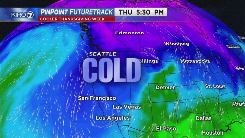
As colder air is forecast to arrive Thanksgiving week, the stock weather app that comes with many cell phones has begun flashing a snowflake a week or more away.
Unfortunately, these "forecasts" are presented without context and don't go through review by local meteorologists. They're just spat out by a computer with no human intervention.
(The KIRO 7 Weather App IS updated by KIRO 7 meteorologists.)
Thus a week away from Thanksgiving, here's a little rumor control:
Cold enough for mountain pass snow Thanksgiving week
This could be of great concern if some serious moisture arrives in the Pacific Northwest at times a lot of folks are traveling the mountain passes.
It will certainly be cold enough for snow at the passes each day and night starting Monday through at least Black Friday (Apple Cup Day.)
But moisture for significant snowfall is most uncertain as of this writing on Thursday, Nov. 21. We're probably going to see some accumulation of snow at the passes on Sunday and Monday of Thanksgiving week -- at least a few inches. Beyond that? We just don't know yet. Stay tuned for more accurate accumulation forecasts as we head into the weekend.
Long-range forecast models point toward a drier forecast for the second half of Thanksgiving week, which could mean just some issues with frost at the passes but this could change as we get closer to the big getaway and travel days around the holiday.
Is there a chance for lowland snow?
The accurate answer is: yes, there is a chance for lowland snow somewhere in Western Washington mid-to-late Thanksgiving week.
But there's an even bigger chance we see no lowland snow at all. %
%
One issue is that the magnitude of cold air in the lowlands will just be marginal for snow. With highs in the 40s, it could well be too warm for any snow to fall during daytime hours over the holiday period -- even if we had plenty of moisture around for snow. Any moisture would then fall as cold rain in the low elevations and most populated locations.
We'd naturally be cooler at night with lows Wednesday through Friday in the 30s or even some spots in the 20s, so nights is when our chance could increase.
But the MOISTURE is key. If we don't have sufficient moisture and weather systems bypass us, then it doesn't matter how cold it is. We're left with sunshine and very crisp days and really chilly nights.
As of the writing of this on Thursday, Nov. 21, forecast models for the period around Thanksgiving are trending drier.
That is not to say it can't change, it certainly can and snow lovers can go ahead and dream. Just don't get your hopes too high, as of this writing there's a better than 50/50 probability those hopes will be dashed. But I'll be updating the forecast on KIRO 7 News as we get closer and the forecast comes into better focus.
(Also, Thanksgiving is usually a little "early" for lowland snow in Western Washington, statistically speaking. Our prime months for snow start in December.)
Cox Media Group


