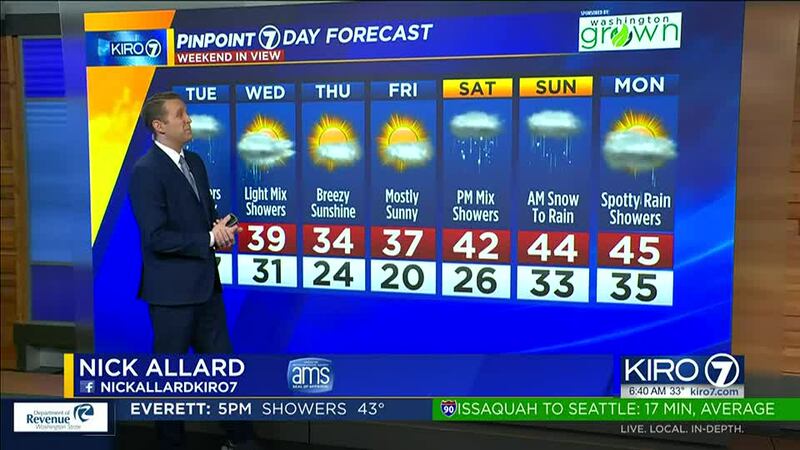
After gusty winds blew across Western Washington, with high avalanche danger in the mountain passes, snow levels and temperatures will drop and snow is again a possibility in the lowlands.
Forecast
Scattered showers are moving through the area with breezy conditions and temps in the upper-30s and lower-40s. Showers will continue here and there Tuesday ahead of another wave that will move through Tuesday afternoon and evening.
Behind this cold front, northeast wind kicks in through the Fraser River and cold air will move over the entire area. There will be some scattered showers around that should fall as snow or wet snow and rain. Spotty accumulation is possible, but most areas will be less than an inch. However, that could change and we need to watch it closely as the showers move through.
By late afternoon and early evening, snow levels will be around 500 feet to the surface. Still, all indications point to moisture drying up Tuesday night with only a few spotty, light snow showers around.
Wednesday looks similar, with just a few showers, but we’ll need to watch the Olympic Peninsula for the potential for more snow showers. Accumulations in the lowlands look minimal — less than two inches — and very sporadic.
The best chances for snow accumulation will be on higher hills near the Cascades. In addition, northeasterly wind will cause some snow around the Port Angeles area, and some accumulations there could be more substantial Tuesday night into Wednesday.
By Wednesday afternoon, the moisture for snow showers should be mainly west of Puget Sound and there will be some late-day clearing. Highs will be in the 40s early Tuesday and only in the 30s Wednesday.
Thursday and Friday will be mainly dry and very cold with lows in the teens and 20s and highs only barely above freezing.
Temperatures start to moderate over the weekend as moisture returns, mainly later Saturday and Saturday night. There could be some wet snow and mainly minor accumulation over the weekend before it turns to all rain in the lowlands by Sunday afternoon. We’ll be watching how that forecast evolves. But we’ll be out of the deep freeze by the end of the weekend.
©2023 Cox Media Group


