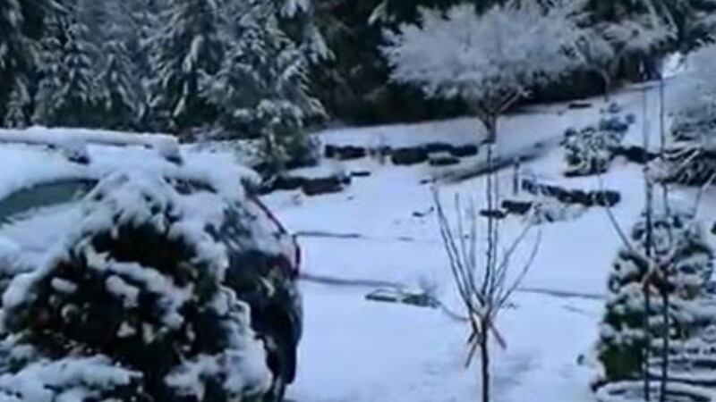
MARYSVILLE, Wash. — People in the North Sound woke up to snow Monday morning.
The heaviest snow fell north of Everett in Snohomish, Skagit and Island counties.
>>Download the KIRO 7 Weather App to track the snow
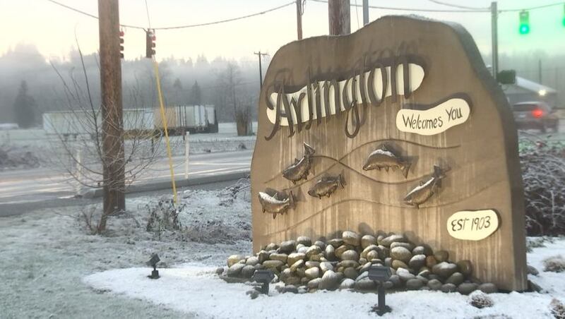
Snow has been reported in such places as Arlington, Granite Falls, Marysville, Stanwood, Mount Vernon, Camano Island among others.
A winter weather advisory was in effect until 9 a.m. for 1 to 2 inches of snow for areas including Burlington, Mount Vernon, Sedro-Woolley, La Conner, Conway, Everett, Lynnwood, Marysville. There will also be snowflakes toward the Cascade foothills in the South Sound.
In some of those areas, Snohomish PUD reported more than 11,000 customers without power, likely from heavy, wet snow.
Snow also fell along the Strait of Juan de Fuca.
A winter weather advisory was in effect for the eastern Strait of Juan de Fuca lowlands, including Port Angeles, Sequim, and Blyn until noon Monday, for up to an inch of snow.
While most temperatures will remain above freezing across the lowlands, any showers could have some wet snow mixed in through the morning hours Monday.
During the daytime hours of Monday morning, a southward-moving front associated with the leading edge of colder air coming in from British Columbia will create some areas of rain and wet snow.
This activity will move from north to south through the midday hours and there could be brief, minor accumulations mainly on grassy surfaces. The best chances of whitening up of the ground will be north of Seattle. Many other locations will see snowflakes but have no accumulation. It’s a reminder that it’s still winter.
Snow came early in the AM & then seemed to dissipate fast across the North Sound - we drove through the elements & were out in it most of the AM @ Noon @KIRO7Seattle w/ @LinziKIRO7 @LaurenKIRO7 @ClaireKIRO7 pic.twitter.com/i6iLYzOsL1
— Ranji Sinha (@RanjiKIRO7) February 21, 2022
A wind advisory is in effect for Whatcom, Skagit and San Juan counties and the north coast for cold northeast winds of 40 to 50 mph. Temperatures in these areas will struggle to get out of the 30s Monday with wind chills in the teens.
>>KIRO 7 StormTracker Doppler Radar Livestream
Elsewhere, highs will be in the upper 30s and lower 40s on Monday with blustery winds by the afternoon. The aforementioned areas of rain and wet snow will come to an end by early to midday. Any accumulated snow should melt.
Looking ahead
The very cold air mass moving in will plunge temperatures into the 20s areawide by Tuesday morning. With clear skies and breezes continuing, we don’t expect any fog but any moisture on the roads will freeze, though any issues with ice Tuesday morning should be relatively isolated.
It will be sunny on Tuesday with highs only in the 30s. The coldest morning will be on Wednesday with a record low of 23 degrees for the date in Seattle. Temperatures will still only be in the 30s on Wednesday, but with sunny skies.
While we’ll start out Thursday in the 20s once again, temperatures will start to moderate on Thursday and Friday and the subfreezing temperatures will be in the rearview mirror. Highs will be in the 40s with mainly clear skies.
Next weekend will feature a weather system moving in, though it looks like rain and mountain snow will hold off until Saturday night or Sunday. Temperatures will be near seasonal norms so that next system won’t bring any threat of lowland snow.
More news from KIRO 7
- President’s Day 2022: What is open, what is closed Monday
- Bernie Madoff’s sister, brother-in-law found dead in South Florida home
- Man injured in shooting at Federal Way gas station
- Do you have an investigative story tip? Send us an email at investigate@kiro7.com
©2022 Cox Media Group