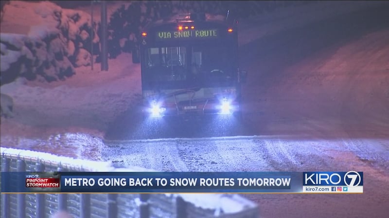
The heavy snow from a series of storms continues to melt Wednesday, with dozens of school districts closed and some roads, especially in the North Sound and Cascade foothills, still difficult.
Weather summary
- Few showers of rain or snow in the morning, little to no new accumulation below 500 feet
- Drying out in the afternoon into Thursday morning
- More precipitation Thursday afternoon through Friday with snow levels 500 feet and up
- Drying out again over the weekend
- Remaining cold next week so chances for wintry precipitation don't totally go away
A weak trough of low pressure moving through this morning producing some lowland rain for the morning hours Wednesday. Snow levels looks to be pretty low -- about 300 to 500 feet but the better chance of it being all snow is in Skagit and Whatcom County as well as above 500 feet toward the mountains.
- School delays and closures
- Power outages in Puget Sound
- PinPoint StormTracker Doppler Radar
- Download the KIRO 7 Weather App
- PHOTOS: February snow in Western Washington
- PHOTOS: Drivers struggle on snowy roads
Further accumulations in areas that have snow won't be much -- an inch or two for the most part -- but it is just insult to injury.
From about Everett south, plenty of slush still is around and while we won't have much rainfall total up, some minor flooding is likely in spots through the morning drive. We could also have some refreezing of moisture on the roads but this is most likely in river valleys, nearer the Cascades and around Hood Canal and in areas north of Everett.
In a lot of our metro areas, we'll hover above freezing which should limit icing.
We'll dry out Wednesday afternoon through Thursday morning. This is good and bad. While we'll have some drying of roadways, some clearing of skies will allow Thursday morning temperatures to be below freezing area wide and I expect any moisture on roads to freeze over. A lot of "new" problems are likely in the early hours of Thursday.
By Thursday afternoon, a front moving in from the south will bring precipitation through the late day Thursday and into Thursday night. The system looks very similar to the weather system that came up from the south Monday...
BUT... temperatures will start out warmer than on Monday and the southerly wind will further increase temperatures so while we probably start out with a rain/snow mix in many spots during the day Thursday, snow levels will quickly pop up above 500 to 1000 feet by evening. I don't expect major problems in our low-elevation heavily-populated spots south of about Arlington. North of there, we could well see more snowfall as well as the high foothills and the mountains. The passes could get pounded again.
Showers of lowland rain and mountain snow taper Friday night into Saturday and while we won't totally clear out Saturday, we'll be drying all day. Sunday will be dry but with the threat of refreezing issues in the morning.
Next week looks colder than normal, still. There could be a weather system somewhere around Tuesday or Wednesday but it's way too early to discern any details as to how strong and predominant precipitation type.
Here's the KIRO 7 PinPoint forecast for Wednesday morning from Meteorologist Nick Allard
SEE THE LATEST PINPOINT WEATHER FORECAST VIDEO
Follow this link to see the latest PinPoint weather video from KIRO 7 meteorologists. The video is on the right side of the overall weather page.
SEA-TAC FLIGHT CANCELLATIONS
Follow this link for flight information in and out of Sea-Tac International Airport.
SCHOOL DELAYS AND CLOSURES
Follow this link to see the latest school delays and closures across Western Washington
KIRO 7 PINPOINT WEATHER APP
Follow this link to see live radar, get custom weather alerts, hourly forecasts, the 7-day forecast and updates on school closings from the KIRO 7 PinPoint Meteorologists.
BUS SCHEDULE CHANGES AND CANCELLATIONS
Metro snow, ice and flood alerts
SKI REPORTS
Get the PinPoint weather video and local ski conditions here.
PINPOINT STORMTRACKER RADAR
HOUR-BY-HOUR FORECASTS AND PINPOINT RADAR
Follow this link for hour-by-hour forecasts, StormTracker PinPoint radar and 5-day forecasts.
SNOW PHOTOS
See snow photos from KIRO 7 photographers and viewer-submitted photos here.
REALTIME TRAFFIC UPDATES
Follow this link for RealTime Traffic updates.
RELATED STORIES
Bread and milk: Why do we buy those foods before a storm?
Winter weather: What is the coldest temperature ever recorded in each state?
Winter weather watch, warning and advisory: What's the difference?
More news from KIRO 7
- Seattle driver arrested in snowball rage incident
- Semi carrying live chickens crashes on I-5 in Olympia
- Snow expected to continue Monday, with some areas getting rain or mix
- Real-Time traffic updates: Snowy, slushy roads snarl morning commute
- Do you have an investigative story tip? Send us an email at investigate@kiro7.com
Cox Media Group


